
With the weather this weekend looking on the more favourable side (so far), we’ve compiled a list with step-by-step instructions for just a few of the walks we enjoy taking on our weekends off:
Hope Cove to Bolberry Down
Before you get underway you could pop in for a light lunch at either The Cove Bar and Restaurant or the Cottage Hotel.


It’s worth remembering there are public toilets in Outer Hope and there is a fee at the car park
Turn left out of car park at Outer Hope and follow the lane through the village. This becomes a path and then a road again down into Inner Hope.

By the slipway, follow the coast path up the steps. Follow the waymarked path, which snakes around Bolt Tail, and along the cliffs.
At Bolberry Down turn down the lane.
At the next T-junction, turn left, then just around the corner fork right. Here you can either stop in the Ocean Restaurant for a ‘swift half’ before embarking on the return journey or carry staring on following the path.
Continuing on past the Ocean Restaurant bear right down hill with a farm and thatched cottage on your right, then climb uphill to a green lane on left marked Sweethearts Lane.
At the next junction turn left signed Public Footpath. The path cuts off to the right by the gateway to Higher Barton and runs across one small field and right along the field margin of the next.
Through gate, turn left at stone stile and tall waymarker post, though adjoining gate and follow the field edge footpath back to Hope Cove.
Cross the road and follow the path down steps by the side of St Clements Church, then turn right and return through Hope to the car park.
The walk consists of a coastal footpath with some uneven ground; surfaced road; green lane; fairly even country footpath.
It’s a moderate walk with one stile, one flight of steps. There are two ascents on the walk, though the climbing is long and steady rather than very steep so not too punishing on the calf muscles.
Grid Reference SX676402
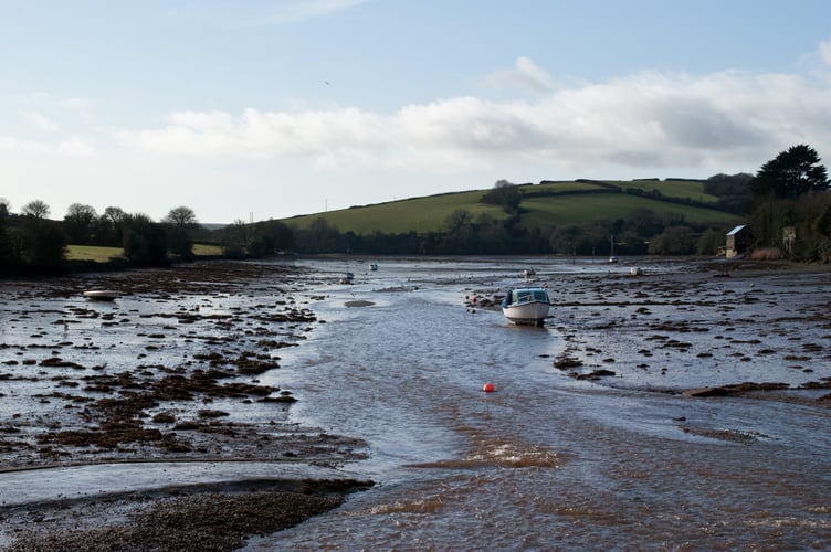
Kingsbridge to Frogmore circular
This is a a 7.5 mile walk exploring some of the Kingsbridge estuary’s creeks – Bowcombe and Frogmore. This is a moderate to strenuous walk which is steep in places but the views are worth the climb!
Remember there are public toilets next to the Quay car park in Kingsbridge.
Turn right out of car park along The Promenade. Turn left into Derby Road, and at the crossroad turn right, still in Derby Road.
At the bottom of the dip follow road up to the left and where road turns sharp right. Ignore this and go straight on up the green lane.
Climb steadily to the top, and half way down the other side follow the Public Footpath over stile on right. Descend steeply and cross the road at the bottom by two stiles. Take footpath to the head of Bowcombe Creek. (A bit of paddling here across stepping stones if it’s very wet.)
Cross the causeway and take foot path straight ahead up the hill. When you reach the road, turn right and follow it up to Duncombe Cross. At the Cross go straight on along the green lane.
In one mile another lane joins from the left. Keep on down the hill to the main road. Turn left and walk towards the village, taking great care on this busy main road.
Turn right onto public footpath signed for Frogmore Creek and West Charleton. Follow path around field edge and along above creek.
Eventually the path drops down onto the foreshore. After 200m follow the ‘Public Footpath’ sign inland.
When you meet the lane go straight on.
On the corner by the fire beacon basket turn left through a metal gate and down the public footpath through field.
At the bottom the path follows the field edge left, then turns right through the hedge bank.
Walk up field to next waymarker, then sharp left onto public footpath following farmer’s track through field.
At the lane turn right. At main road turn left along the footpath.
Turn left along the road to the church. Turn right up Church Lane.
Take the footpath to the left, just before the allotments. Walk 3/4 mile back to the head of Bowcombe Creek.
Turn left onto the bridge and follow the footpath back to the road.
Take the left hand footpath across and up the steep field. Cross the stiles, keeping to the hedgeline back towards the Rugby club.
Keep right through rugby club car park. Cross road and stile onto footpath down steep scrubby field.
Join the road left, then turn immediately left through the recreation ground. At the road, cross and turn right to follow the creek back to the car park.
This is a 7.5 miles walk which is moderate to strenuous with a steep ascent and descent, six stiles and some surfaced and unsurfaced paths.
Grid Reference SX 735 439
Dartmouth
Our next recommended walk is a 1.8 mile track from Dartmouth Castle to Gallants Bower and Compass Cove and return.
This is a peaceful woodland walk up to the earthworks of a Civil War fort, then around the headland to enjoy views along the coast and out to sea.
Follow the path up to the left of the old ruined castle, signed ‘Coast Path Stoke Fleming 3½ miles and go up the steps .
At the top, cross road to left and take the path up to the right into the woods, past the National Trust ‘Gallants Bower’ sign.
Follow the path which climbs steadily as it wends its way up through the woods, until you emerge into the open and reach the old earthworks. The site is fairly small and easily explored.
Retrace your steps then take the next path on the right to lead back down to the lane, turning right to follow it along.
After 400m, past the old Coast Guard cottages, go straight on through the gate ahead and around the top of the scrubby field.
Just before the gate at the far end of the field turn left and follow the hedge down for 100m then turn left again along the Coast Path

The path drops steeply down the field. Towards the bottom bear left following the Coast Path waymarker along open area. At the fingerpost you can follow an optional detour right down the footpath and steps to Compass Cove. Retrace your steps
At the fingerpost go straight on. Go through the gate into the wooded area and follow the rocky path up the hill.
Follow the path as it begins to climb again, and passes through woods.
When you meet the road turn right. After 300m turn right back down the steps to Dartmouth Castle.
The route is 1.8 miles and is easy to moderate with some steps and inclines
Grid reference SX 886 503
Totnes Town Trail A walk through Totnes’ narrow streets to discover a town crammed full of history. This walk can be extended by following the River Dart to nearby Dartington along the riverside path.
Starting at The Plains, turn left into Fore Street. Conitinue up the hill stopping at points of interest: The Gothic House, The Mansion,
Atherton Lane, The Brutus Stone, Totnes Museum, East Gate – At the gate, turn right up the steps and follow Ramparts Walk
Ramparts walk, Marys Church – Turn left to enter the churchyard, returning to the route afterwards
The Guildhall – After visiting the Guildhall turn right past Guildhall Cottage and then immediately left into Church Close and walk back towards the High Street
The Butterwalk – Turn right onto the High St and continue up the hill. The Butterwalk is the covered walkway in front of you. After leaving The Butterwalk, turn right into Castle Street. Just before the North Gate to your left, stands the Castle.
Totnes Castle – From the castle, return to the High Street, turn right and walk through The Narrows towards the site of the old West Gate. Turn left across the open space area called The Rotherfold and walk up Leechwell Street, towards the site of the old West Gate. Turn left across the open space area called The Rotherfold and walk up Leechwell Street, towards the Kingsbridge Inn
Leech Wells, Civic Hall and market place
The walk is easy to moderate as is one mile
One mile easy to moderate stroll with a steep climb in the High Street and surfaced paths
Grid reference SX 805 602
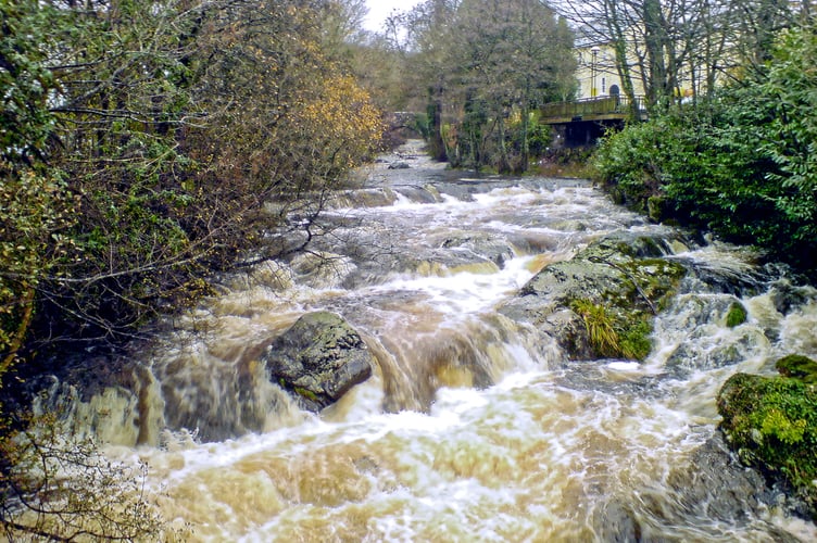
The River Erme- Ivybridge to Ermington
This is a lovely wander following the valley of the River Erme, in an area where the wild beauty of the moor and the mellow delights of rolling South Devon meet and merge.
For much of its length, the walk follows the green and white Erme–Plym Trail / Coast to Coast waymarkers.
From the Leisure Centre in Ivybridge, take the riverside path downstream. Walk along the main road then turn right opposite the recycling centre and follow path around edge of playing fields.
Turn right along the road, then right again onto a footpath front of Yeo Bungalow, across fields and along river.
Turn left at road, and then first right at Caton Cross. After 200 metres bear right through a metal gate, and across fields. Bear left, walking uphill to get top next gate when crossing an open field via the telegraph pole, and follow the next field edge to the road. Turn right. At main road, take footpath opposite and to left, signed ‘Sequer’s Bridge’.
Follow yellow waymarker arrows across fields, following the river before looping up the hill. Cross a wooden stile, passing though a farm towards the main road
At the main road turn right then right again to follow the riverside path back up towards Ermington.
Cross the main road and after 220 metre turn left up Town Hill into Ermington. Walk up to the village pub at the top.
Take cobbled path to right of pub and cross fields to the church. Drop straight down from church to road and turn right. Turn first left down road past the school.
At main road turn left over bridge, then left again up lane signed for Penquit and Strode. From here you are retracing your earlier steps.
Turn left beyond brow of hill onto public footpath and follow yellow waymarkers back through fields.
Bear left at the road. Turn left at Caton Cross. Turn right just before Keaton Bridge onto riverside Where path enters field, fork away from river along remains of green lane and field edge.
Turn left onto footpath alongside road. After 200 metres, turn left and follow path around back of playing fields alongside river. Turn left opposite recycling centre and follow river back to car park.
This is an 8.5 miles moderate walk with many stiles, three of which can be bypassed, one flight of steps and a stretch of busy road. There are footpaths often through fields, fairly even underfoot occasional mud after rain and surfaced roads.
Grid Reference SX636561
Comments
This article has no comments yet. Be the first to leave a comment.